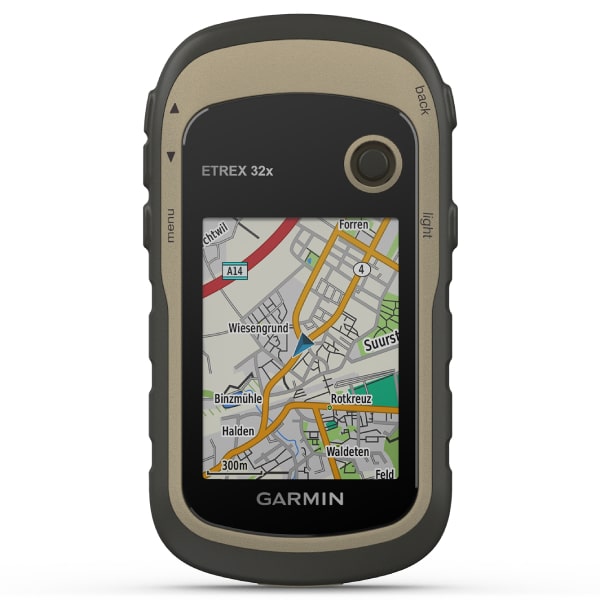
Garmin eTrex 32x Rugged Handheld Hiking GPS with Compass and Barometric Altimeter
$299.99
The eTrex 32x offers the same ease-of-use, durability, and affordability that the eTrex handheld GPS series is known for — along with preloaded TopoActive maps. These devices are perfect for ATVs, bicycles, boats, or hiking.
Garmin eTrex 32x Rugged Handheld Hiking GPS with Compass and Barometric Altimeter
- Ability to Add Maps: Yes
- Area Calculation: Yes
- Automatic Routing (Turn by Turn Routing on Roads) for Outdoor Activities: Yes
- Barometric Altimeter: Yes
- Basemap: Yes
- Battery Life: 25 hours
- Battery Type: 2 AA batteries (not included); NiMH or Lithium recommended
- Compass: Yes (tilt-compensated 3-axis)
- Connections Wireless Connectivity: Yes (ANT+)
- Custom Maps Compatible: Yes (100 custom map tiles)
- Dimension: 2.1″ x 4″ x 1.3″ (5.4 x 10.3 x 3.3 cm)
- Display Resolution: 240 x 320 pixels
- Display Size: 1.4″ x 1.7″ (3.5 x 4.4 cm); 2.2″ diag (5.6 cm)
- Display Type: 2.2″ transflective, 65K color TFT
- Displays National, State and Local Parks, Forests, and Wilderness Areas: Yes
- External Memory Storage: Yes (32 GB max microSD card)
- Geocaching-Friendly: Yes (Paperless)
- GLONASS: Yes
- GPS: Yes
- GPS Compass (While Moving): Yes
- High-Sensitivity Receiver: Yes
- Hunt/Fish Calendar: Yes
- Includes Detailed Hydrographic Features (Coastlines, Lake/River Shorelines, Wetlands and Perennial and Seasonal Streams): Yes
- Includes Searchable Points of Interests (Parks, Campgrounds, Scenic Lookouts and Picnic Sites): Yes
- Interface: Mini USB
- Map Segments: 3000
- Memory/History: 8 GB
- Model: 010-02257-00
- Navigation Routes: 200 routes, 250 points per route; 50 points auto routing
- Navigation Track Log: 10000 points, 200 saved tracks
- Picture Viewer: Yes
- Point-to-Point Navigation: Yes
- Preloaded Maps: Yes (TopoActive; routable)
- Sun and Moon Information: Yes
- Tracks: 200
- VIRB Remote: Yes
- Waterproof: IPX7
- Waypoints/Favorites/Locations: 2000
- Weight: 5 oz (141.7 g) with batteries


Reviews